


Updated 11 November 2025
Deformation beneath Svartsengi continues, although at a slower pace than before.
There is still uncertainty regarding the timing of the next event.
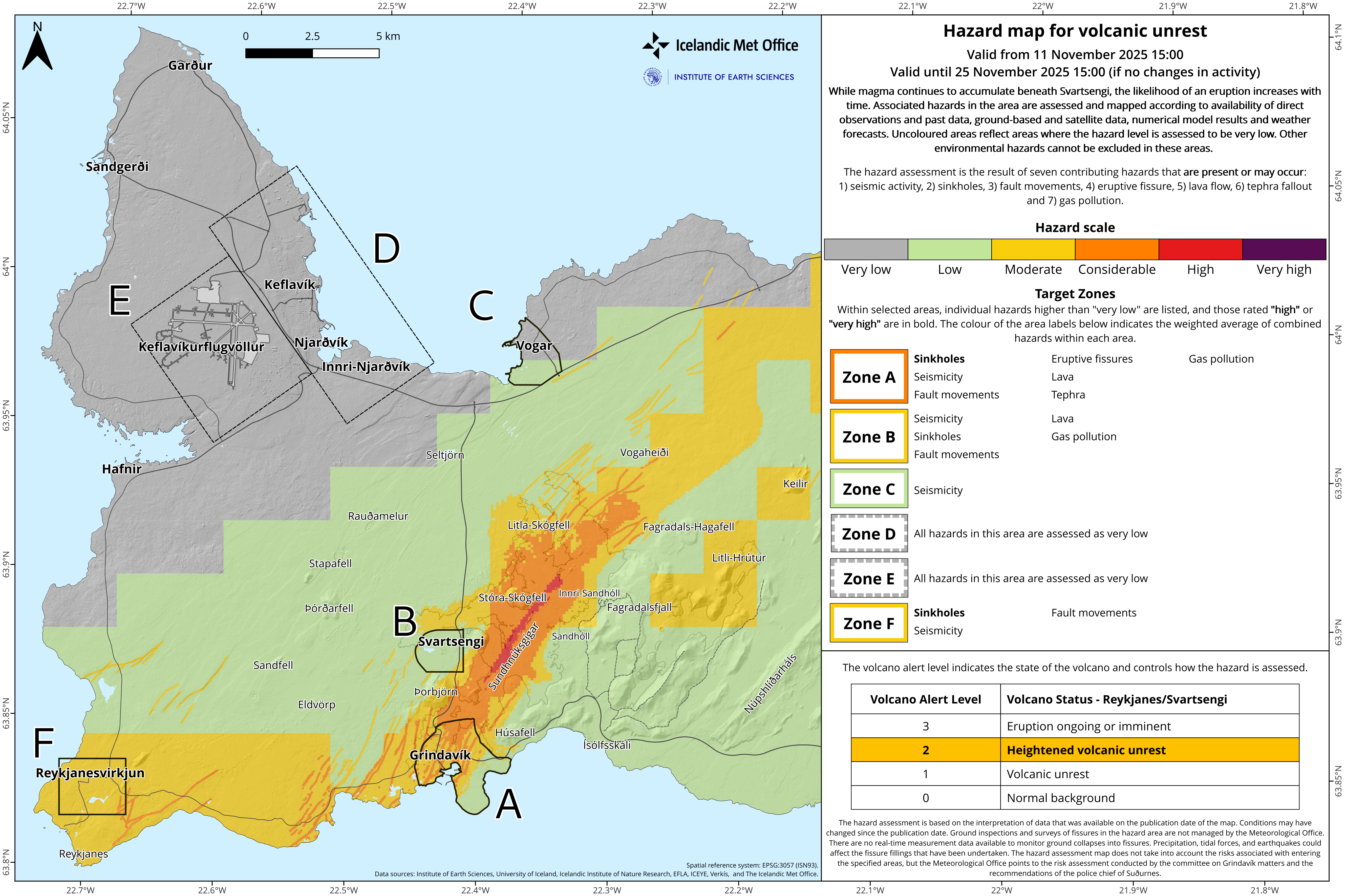
The hazard assessment has been updated and remains unchanged until November 25, unless changes occur.
Seismic activity in Krýsuvík has significantly decreased in recent weeks.
Deformation measurements indicate ongoing uplift and magma accumulation beneath Svartsengi, although the rate of magma inflow is gradually decreasing.
Based on previous events on the Sundhnúkur crater row, the likelihood of a new magma intrusion and eruption increases when a comparable amount of magma has accumulated beneath Svartsengi as before the last eruption. The amount of magma that has drained from Svartsengi during eruptive episodes since March 2024 has varied, ranging from 12–31 million cubic meters. According to model calculations, about 15 million cubic meters of magma have now accumulated beneath Svartsengi since the last eruption in July. Therefore, there is still considerable uncertainty about when the next event will occur.
As inflow decreases, the timeframe for a possible next event has lengthened. The accompanying graph shows that the lower volume threshold was reached in early October, while the upper threshold is projected to be reached in early February, assuming inflow remains unchanged. The upper threshold is set at 23 million cubic meters of magma, which is the average amount that has drained from Svartsengi during the last five eruptions.
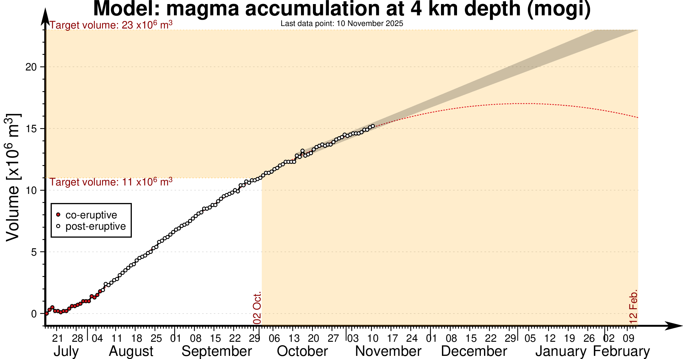
Model of magma accumulation at 4 km depth beneath Svartsengi since 17th July. The black circles show daily measurements of magma volume from July 2025 to the present day. The shaded area represents a forecast of magma accumulation at a constant inflow rate, while the red dashed line indicates a likely trend if the inflow rate continues to decrease. The volume thresholds of 11 and 23 million cubic meters are estimated model bounds for a potential magma intrusion and eruption.
Earthquakes near Grindavík and along the Sundhnúkur crater row are few and small; most days only a handful of microearthquakes are detected, around or just above magnitude M1.
Deformation measurements show that the subsidence that began in Krýsuvík this summer has slowed significantly, and deformation is now minimal in the area. Earthquakes in Krýsuvík still occur a few times per day, but activity has decreased substantially. The total number of earthquakes has dropped from 250 down to 100–150 per week. This is the first time since summer that the earthquake pattern shows a continuous decline.
The hazard map has been updated and remains unchanged until November 25. The Icelandic Meteorological Office continues to monitor developments closely and will update information if changes occur.

www.malaymail.com/news/world/2026/01/11/bomb-attac…
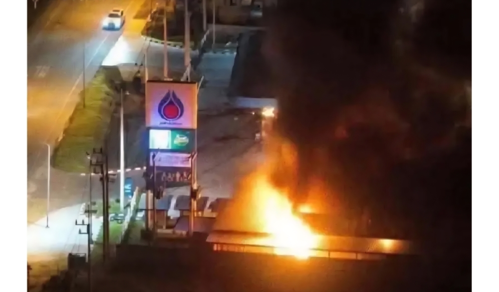
BANGKOK, Jan 11 — A series of late-night bomb attacks targeted 11 PTT petrol stations in Thailand’s southern border provinces of Narathiwat, Pattani and Yala…
www.khaama.com/at-least-eight-refugees-die-37-resc…

At least eight refugees died and 37 were rescued when their boat sank off Badmeli near Izmir, Turkish authorities said on Saturday.
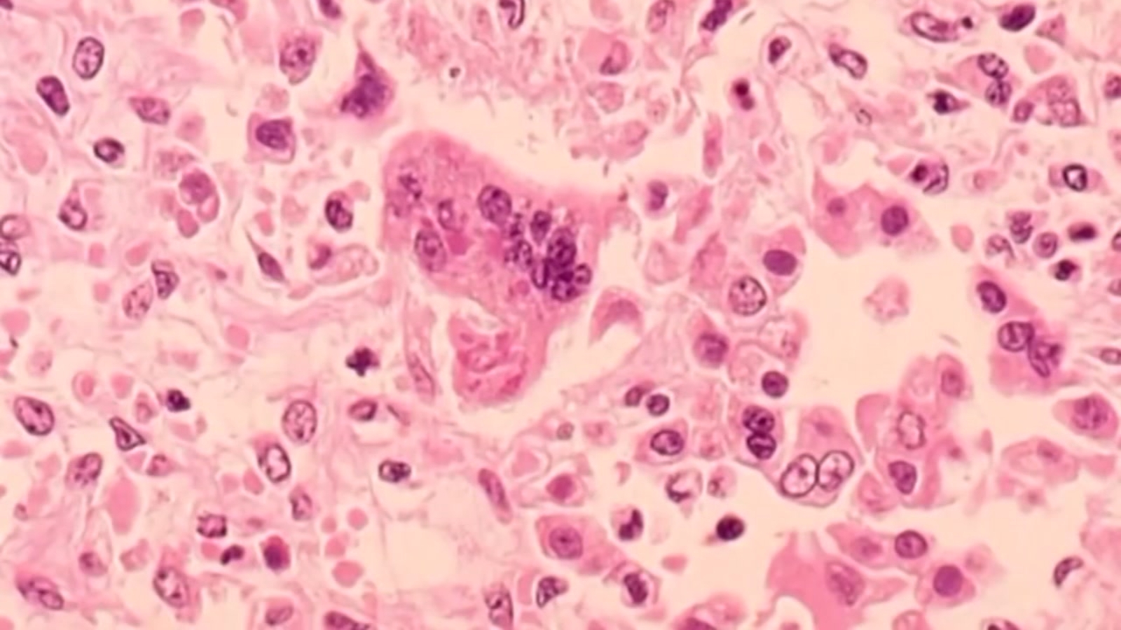
katu.com/news/local/oregon-confirms-first-measles-…

Health officials in Oregon have confirmed the state's first measles cases of 2026, with two people diagnosed in Linn County.
abc11.com/post/measles-north-carolina-state-report…
Measles in North Carolina: State reports 5th case linked to South Carolina surge